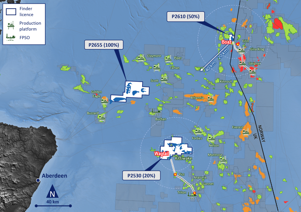
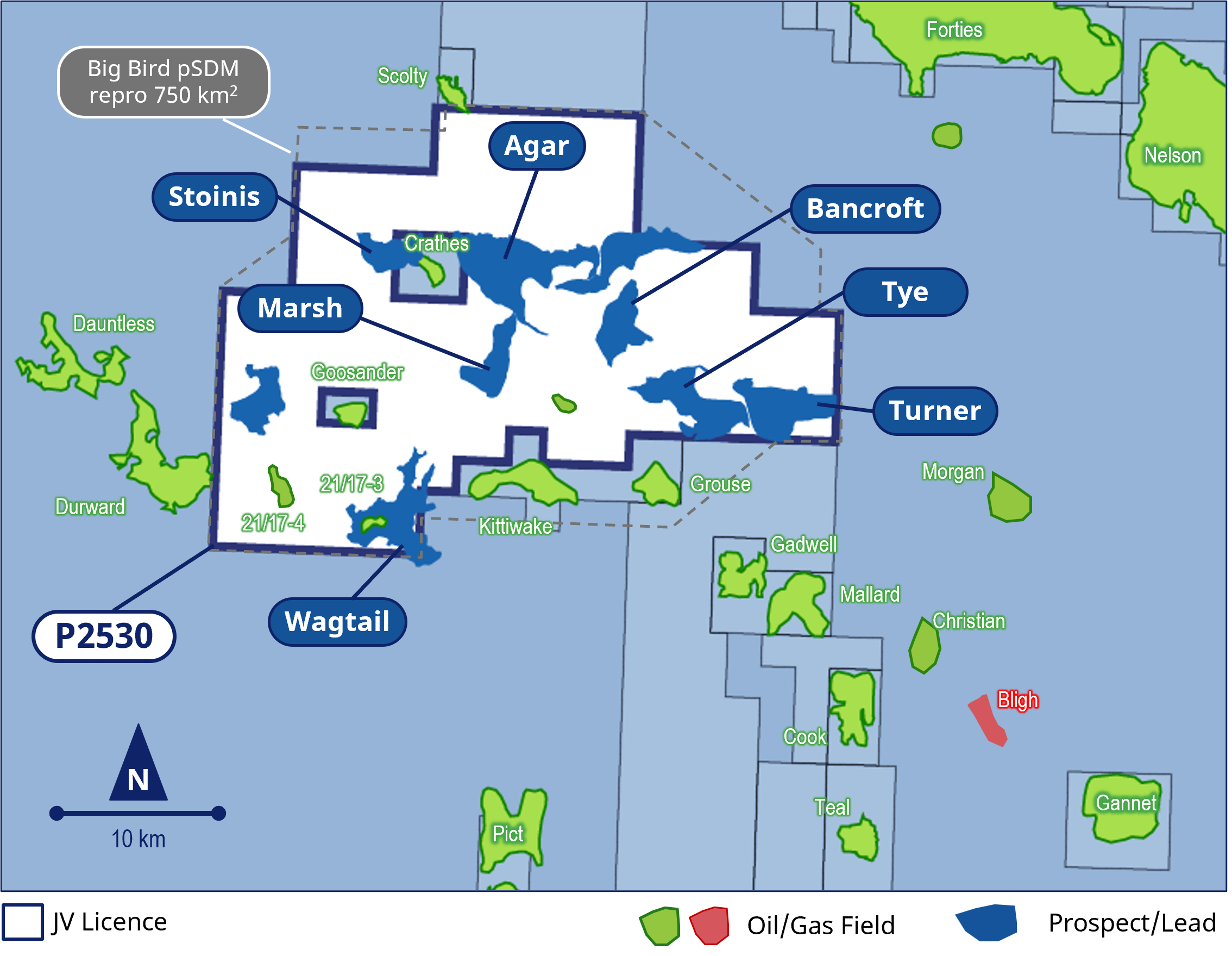
Location and Status
Basin: West Central Graben, Central North Sea
Area: 576 km2
Water Depth: ~85 – 110 metres
Status: Seaward Production “Innovate” Licence – Phase B (1 Dec 23 – 31 Aug 26)
Interests
Finder Energy (20%, Permit Administrator)
Dana Petroleum (E&P) Limited (40%)
Serica Energy (UK) Limited (40%)
|
Highlights: The new Big Bird 2022 broadband pSDM 3D reprocessing has unlocked the Fulmar play prospectivity within the licence. The Jurassic Fulmar play is proven by nearby Kittiwake, Goosander and Grouse fields. Multiple classic Fulmar interpod ILX prospects have been de-risked and are clearly imaged on the new data. Additional significant follow up prospectivity with success. Multiple host tie-back options nearby. |
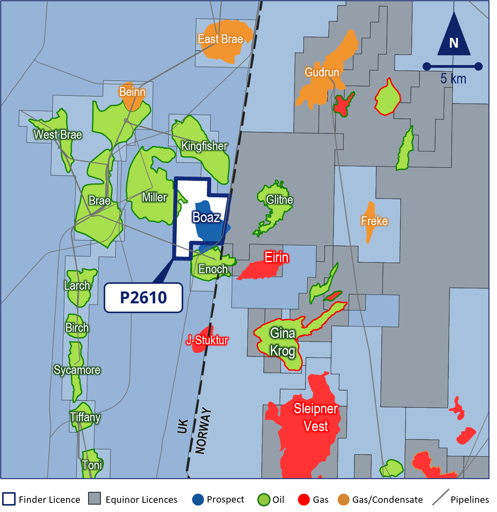
Location and Status
Basin: East Shetland Basin, Northern North Sea
Area: 44 km2
Water Depth:~110 metres
Status: Seaward Production “Innovate” Licence – Phase A
Interests
Finder Energy (50%, Permit Administrator)
Equinor UK Limited (50%)
|
Highlights: Finder awarded priority 33rd UKCS bid round licence with strategic partner Equinor. Located in the prolific South Viking Graben, the License contains the large Boaz gas/condensate prospect and is close to host facilities operated by Equinor, including Gina Krog and Sleipner. Phase A technical work programme with drill decision prior to end of 2027. |
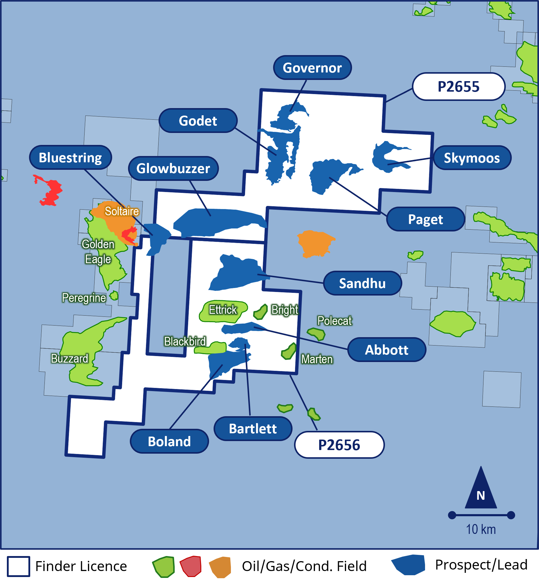
Location and Status
Basin: South Halibut Shelf
Area: 573 km2
Water Depth: ~100 metres
Status: Seaward Production “Innovate” Licence – Phase A
Interests
Finder Energy (100%, Permit Administrator)
|
Highlights: New high-end modern reprocessing is proposed, extending the recently completed Big Buzz 3D. Multiple Upper Jurassic prospects have been identified similar in age to nearly oil fields. |